| Where? | Description | What? |
|---|---|---|
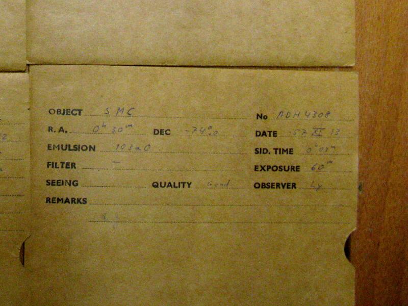
| Link (70 kiB) | Scan of the plate envelope | #documentation ivo://org.gavo.dc/~?boydende/data/fits/HAR081_004308.fits |
| (Form) | The Armagh-Dunsink-Harvard Becker-Schmidt Telescope was deployed at Boyden Station, Maselspoort South Africa between 1965 and 1970. During that time, astronomers from Bamberg, Heidelberg, Hamburg and M?nster took astronomical images there, with a focus on old star clusters, the Magellanic clouds, and the southern milky way. This service provides scans of the plates obtained. | #proc ivo://org.gavo.dc/~?boydende/data/fits/HAR081_004308.fits |
| Link (385 MiB) | The full dataset. | #this ivo://org.gavo.dc/~?boydende/data/fits/HAR081_004308.fits |
| Link | A preview for the dataset. | #preview ivo://org.gavo.dc/~?boydende/data/fits/HAR081_004308.fits |